|
|
SEA OATS BEACH
What a lovely sight driving along U.S. One just a few feet from the azure blue waters of the Atlantic Ocean from MM74.5 to MM75 on Lower Matecumbe. No homes between you and the ocean. So close you can almost touch the sea! Sheer beauty.
Most people call the area Sea Oats Beach, but not everyone.
Click here to learn about other names - What’s In A Name
Over the years, locals have watched as the beach has gotten narrower and narrower each year. Many remember the billboard installed on the beach when there was still expanses of dry land. Eventually the billboard was part way out into the ocean.
Click here to see photos and read the story – Sea Oats Beach Billboard.
The view along the beach is spectacular, but that is just about the end of the good news: The close proximity of the highway to the shoreline of the Atlantic could well spell future disaster.
FKEC project: In 2021 the Florida Keys Electric Cooperative expects to begin a project: moving the power transmission poles from the shoreline at Sea Oats Beach to the bay side of U.S. One.
Click here to read about the FKEC project
Who would be impacted: Lower Matecumbe Key residents and Florida Department of Transportation (FDOT) officials share deep concern about the precarious stretch of low-lying U.S. 1 at Sea Oats Beach. Not just the folks living on Lower Matecumbe have to worry, but everyone who travels the Florida Keys beyond this island - tens of thousands of residents, property owners, and tourists heading south. It has been known for years that this stretch of highway is in serious jeopardy from storms, large and small, long before "sea level rising" became a concern. If this section of highway is washed away, there will certainly be desperate and angry calls for help from areas to the south.
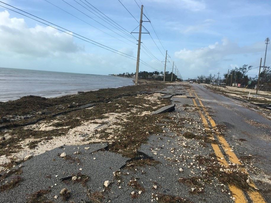
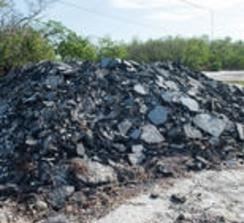
| When Hurricane Irma invaded in 2017, the damage to U. S. One at MM74.5 was primarily limited to one lane, but repairs created huge congestion for vehicles traveling south past this location for months. After a major hurricane, it is critical that U.S. One be clear to get emergency services through. After Irma, a pile of broken asphalt pieces was stacked on the side of the highway. |
|
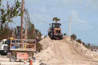
Sand recovered from the highway, was piled on the right of way at MM74.5, cleaned and filtered, expected to be used for future restoration of Sea Oats Beach. The Village soon realized it would be years, if ever, before any restoration of the beach would be possible. The sand was given away. |
|
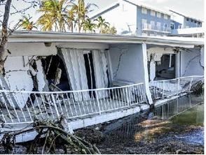
| Matecumbe Sandy Cove condominium was a 12-unit three story complex immediately across the highway from Sea Oats Beach. It completely collapse with just the top floor still visible following the destruction caused by Hurricane Irma. |
January 2021
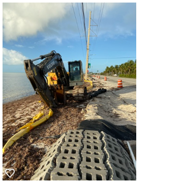
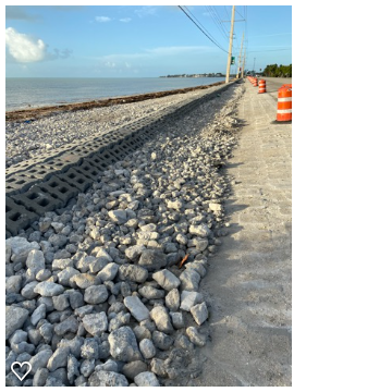
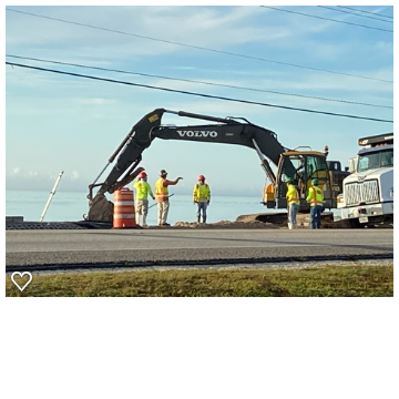
Now, more than three years after Hurricane Irma, FDOT is in the process of stabilizing the shoreline by repairing the embankment washout at Sea Oats Beach. During this project they are re-using the erosion control articulating block mat (ABM), installed during a highway shoulder stabilization in 2008, adding another layer, and placing rip-rap below grade. FDOT expects this will be a “more permanent and stable” system.
|
|
|
Five Year Plans
A year after Irma, at a public meeting in Marathon in November 2018, a tentative Five-Year Work Program was presented by FDOT as is done regularly each fall. In the 5th year of that plan, 2024, FDOT projected they would do preliminary engineering for the section of highway from MM74– MM75, Sea Oats Beach, at a cost of $1.5 million. This was intended to be the start of the long term “fix,” a design to raise the level of U.S. One, perhaps significantly.
At a Lower Matecumbe Key Association meeting several months later, FDOT engineer, Daniel Iglesias, explained that “major construction projects require detailed designs, extensive permitting by multiple state and federal agencies, and multimillion-dollar funding.”
“We understand you want to see something done quickly, but it has to be done the right way” Iglesias said. He later added, “There is no way to raise the road to address a 15-foot-high storm surge.”
The most recent 5-year plan was presented virtually in October of 2020. FDOT Officials now say they’re in the early design stages of a road improvement project from MM 73.7 to MM 77.5, referred to as a paving project. The road and shoulders will be elevated 1 to 1.5 feet in most locations. The highway by Sea Oats Beach is to be raised by 2 feet.
Initial engineering was submitted on September 23, 2020. The design work is expected to take a year. Any additional runoff created as a result of the project will be addressed with installation of drainage inlets, swales, trenches and underground piping. The estimated $10 million construction project is to start in the spring or summer of 2022.
If you believe at all in “sea level rise,” you will join a majority of residents of Lower Matecumbe who question whether two feet of added elevation will do anywhere near enough to justify the cost and the extended traffic congestion that will result.


