|


CHECK THE TRAFFIC - LIVE FEED CAMERAS ON US1
Check the Traffic – using Florida 511
There are cameras on some of the power poles through the Keys monitoring the traffic.
You can watch, too. Click on Florida Cameras | View Live Florida Cameras | FL511
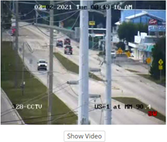
Near the top of the page under “CAMERAS,” click on “Filter” to select Southeast Florida, Monroe County and U.S. One. This will take you to a screen that displays the camera images starting at MM109 and heading south as you page down. Under the image you can click on “show video” to see live traffic.
In Islamorada
The cameras are located on power poles at MM90.4, MM86.2, MM80, MM77, and MM74. At the top of the camera image you will see the date and time. At the bottom. you will see the location.
| Florida 511 Mobile App You can also get a mobile app for your cell phone (FL511): Get up-to-the-minute, real-time traffic conditions and incident information for the State of Florida with FL511, now featuring Drive Mode and Voice Interaction. Check local traffic conditions or get information statewide. |
FL511 is the abbreviated name, which is the state’s official source for real-time traffic and travel information. It is a service of the Florida Department of Transportation (FDOT). The system provides directions to a destination with travel times and alternate routes on all interstates and most US and state routes in Florida. Users can also get information on crashes, congestion, construction, closures and detour routes on Florida’s interstates, toll roads, and other major roadways. The system includes a website, mobile app, text alerts, social media pages and more.
FL511 also has Drive Mode, a feature that allows the user to type in a destination, get up to three routes and drive times, and choose which route to take. Once selected, the user can see turn-by-turn directions.
Travel Smart with the updated Florida 511 Mobile App – Connect. Know. Go.
Features:
- Voice interaction feature functionality. Users can speak a request for a city, county, or roadway to view relevant events.
- Lists of all events displayed by the Mobile App along with their associated camera snapshots.
- Ability to create and save destinations as well as import destinations from FL511.com.
- Truck parking locations and availability (Truck parking facilities list now sorted based on proximity).
- Ability to display road closures and detour routes on the map.
- Added cameras to the map (can be enabled in settings).
- Added messages signs to the map (can be enabled in settings).
- Added a second nearby camera image to incidents, where available.
- Added a new distinct icon for congestion incidents.
- Incidents list sorted based on proximity.
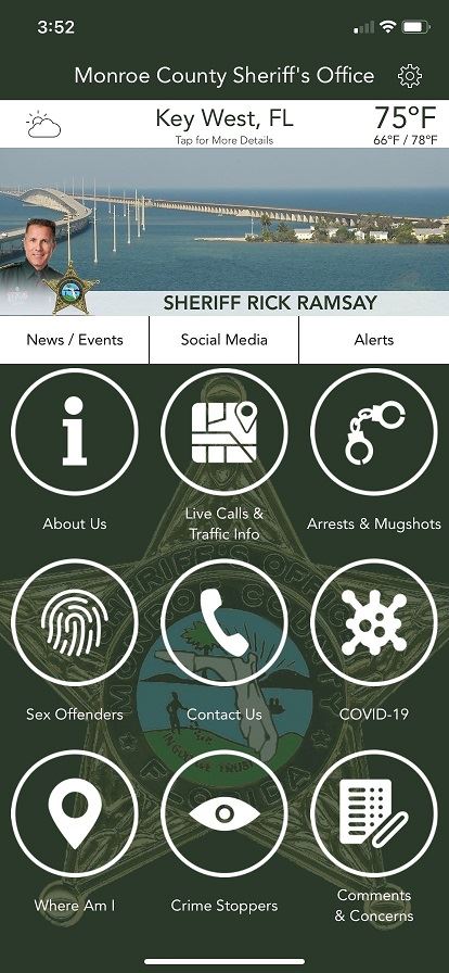
Local updated traffic reports are also available on the Monroe County Sheriff's Office App. This app too can be downloaded to your smart phone from the app store. |
|